Kornati National Park

27
Jul 2024
Kornati Islands, located in the southern part of the North Dalmatian islands...
7 nautical miles from Murter and 15 nautical miles from Sibenik and Zadar, this place delights with its natural beauty, untouched by human hands.
Kornati National Park
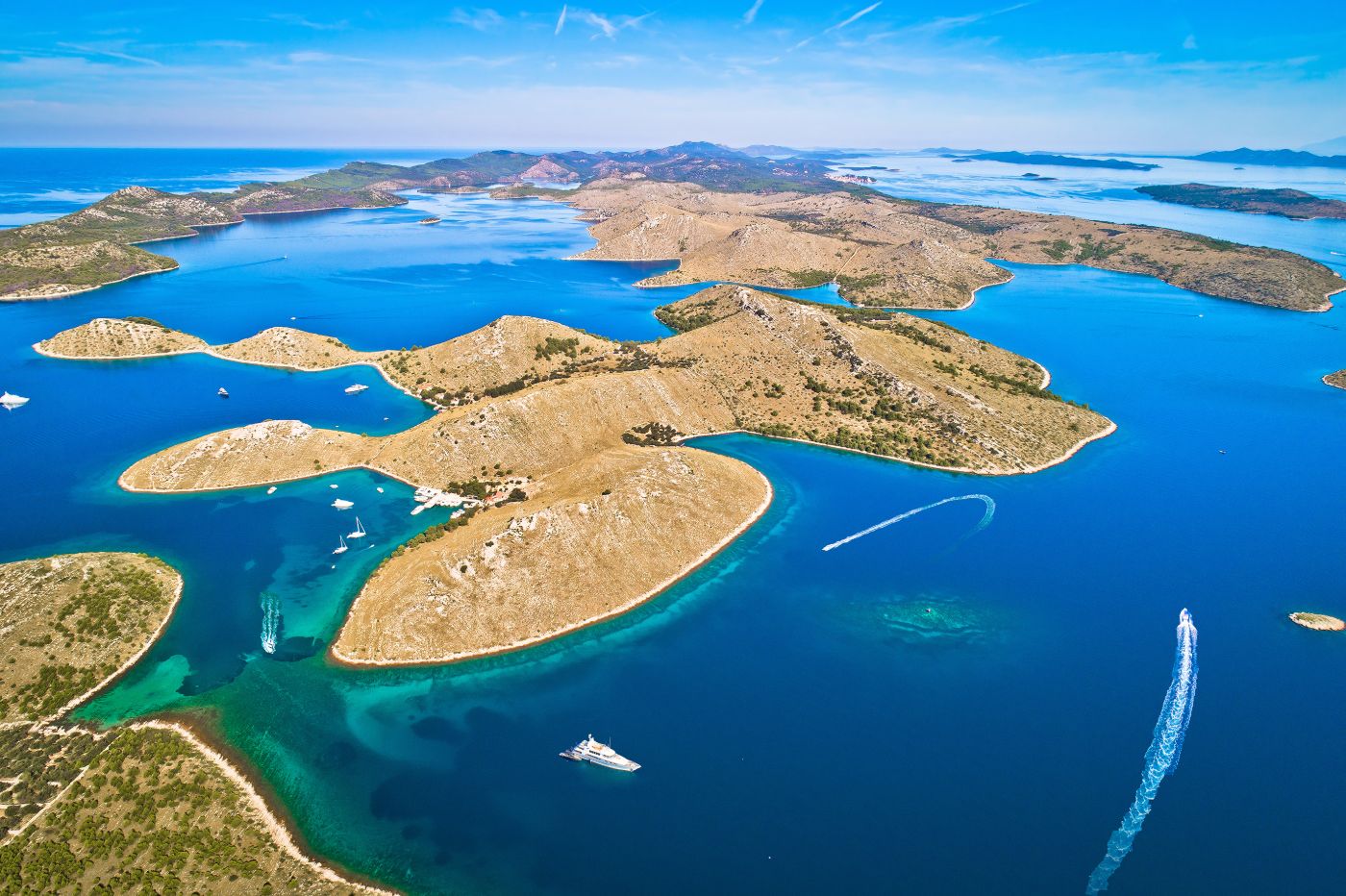
The Kornati Islands, located in the southern part of the North Dalmatian islands, 7 nautical miles from Murter and 15 nautical miles from Sibenik and Zadar, are a place that delights with its natural beauty, untouched by human hands.
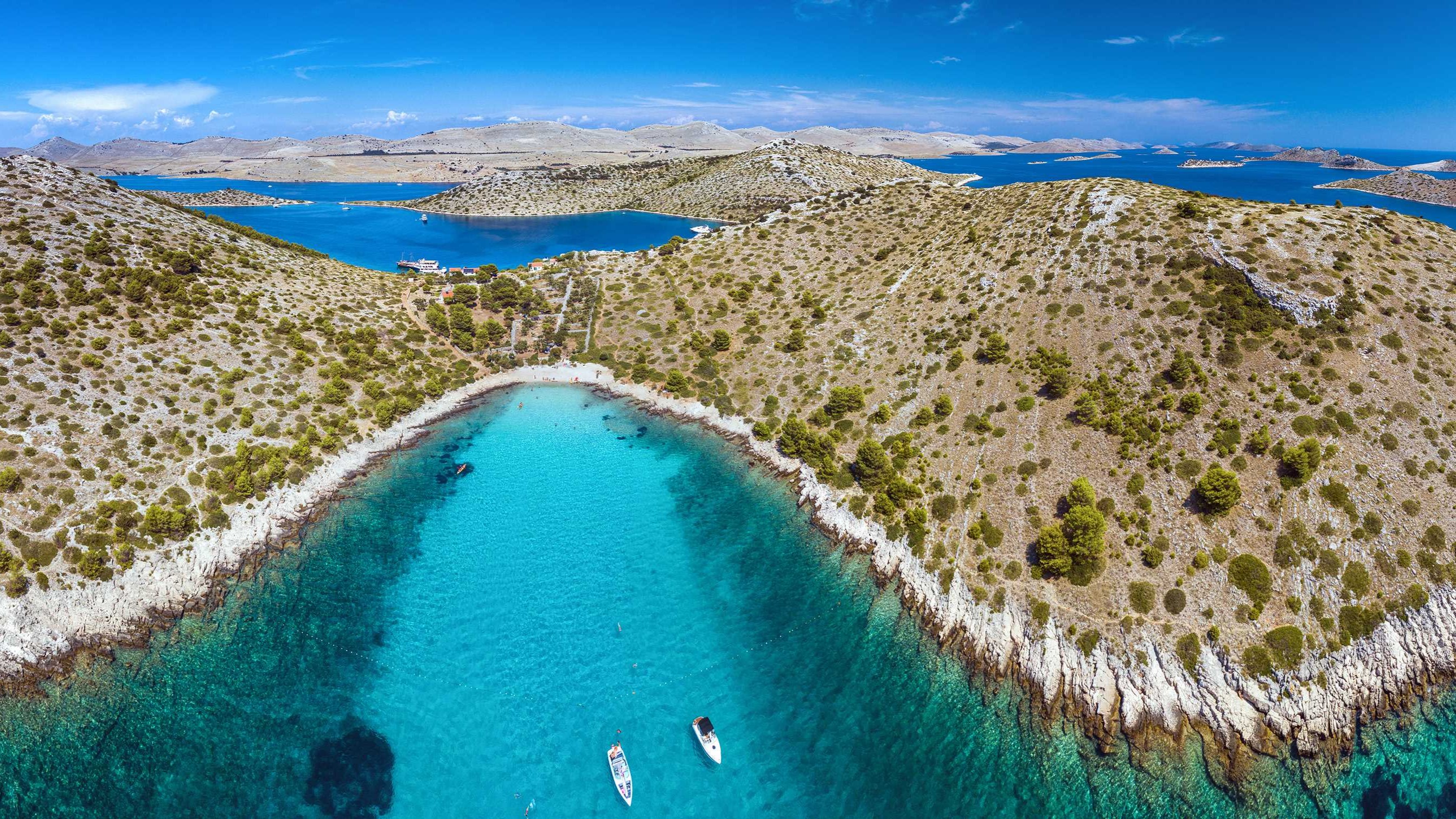
This magical place is characterized by exceptional natural beauty, crystal clear sea, interesting geomorphology, "jagged" coast and a unique marine ecosystem.
It is a large group of islands, islets and reefs near the islands of Dugi Otok and Žut. They represent the most "ragged" archipelago in the Mediterranean Sea. The islands look like pearls placed above the sea.
The National Park, which was proclaimed in 1980, has an area of 220 km² and includes 89 of 150 islands, islets and reefs. The park on the mainland accounts for only a quarter of the total area, the largest part being the part of the sea.
In the immediate vicinity of the island of Dugi Otok there is the Telašćica Nature Park. On the largest island of Kornat (32.5 km2) there is the highest point of the archipelago - Metlina hill (237 m).
Within the National Park there are four strictly protected areas, consisting of islands and reefs that are not accessible to tourists.
Due to the harsh conditions, the vast majority of the islands are uninhabited. However, there are places where descendants of native islanders come in the summer. Then the old Dalmatian cottages become colorful and lively. Remnants of fishing villages and houses adapted for tourism can still be found, especially on the coast. The islands are privately owned and the owners are mainly residents of the islands of Murter and Sali. Individual plots are separated by stone walls and the mosaic that forms them is one of the most interesting cultural attractions of the National Park. Free-grazing sheep on rocky pastures complete this idyllic picture. Traditionally, olives, grapes, fruit and vegetables are grown on more fertile parts of the land. The lack of surface water is replaced by rainwater and crushed dew.

The Kornati island chain was named after the largest island, Kornati. This name is related to a well-known phenomenon occurring in the park - the crown. This is the name of the steep cliffs on the outer side of the island that run deep into the sea. All of this is the result of extensive geological activity as the African tectonic plate slid beneath the Eurasian plate to conquer part of the Earth's surface. The longest "crown" above sea level is located on the island of Mana (1,350 m above sea level), and the highest on the island of Klobučar (82 m). The deepest underwater reef can be seen when diving on Piskera Island (over 90 meters). Rock climbing or individual diving (only under the supervision of the diving center) is not allowed.
A unique and unforgettable experience are the views from the tops of the islands. Already marked routes lead to them. The highest peak is Metlina (237 m) on the island of Kornat. In the south-eastern part of this island there is a breathtaking perspective of the Opat hills and a beautiful view of the sea. The entire national park can be seen at your fingertips from the islands of Otočevac and Piškera.
An interesting and frequently visited tourist destination is Magazinova Škrila on the island of Kornat. It is a unique piece of limestone that slipped from its base long ago, after the formation of the islands, probably due to an earthquake. In the bay of the island of Lavsa you can still see the remains of medieval salt storage. The Kornati archipelago has been inhabited since prehistoric times. Numerous remains of rectangular structures, settlements and typical stone slopes have survived from the Illyrian period. There are also traces of other cultures such as Roman, Byzantine, Venetian and of course Croatian. The former main source of income was primarily animal breeding and fishing. The most interesting monument is the preserved Byzantine fortress on the island of Kornat - Tureta, probably from the 6th century, from which it was checked whether the Adriatic Sea was not too dangerous for sailing. At the foot of the fortress there is the medieval church of Our Lady of Tarca, where a Marian pilgrimage takes place every year on the first Sunday of July. On this occasion, guests come to the area in hundreds of boats.
The natural wealth of the Kornati National Park is particularly well cared for. Although most of the islands do not have rich vegetation, the estimated number of plant species and subspecies is 700 - 800. Due to the lack of vegetation, the islands in particular are home to birds, reptiles and amphibians. It is a rich marine world with over 350 species of marine plants and countless species of marine life (approximately 2,500-3,000 species), of which 160 are fish species.
The surface of the islands is dominated by karst formations composed of limestone and dolomite - caves, depressions and valleys, which are partly underwater. They consist of bare stone, which contrasts interestingly with the rich underwater world. The climate on the islands is mild, with dry, hot summers.
Entrance to the national park is subject to a fee, and tickets can be purchased at two reception desks of the Park (higher price) or at selected marinas and tourist offices on the coast. The headquarters of the Kornati National Park is Murter, where you can get all the information, brochures, maps and souvenirs.
You can visit the park by your own boat or on an organized trip with tourist agencies from neighboring coastal cities. You can find many activities here - explore the islands by sailboat, engage in recreational fishing, dive, swim, ride a bike, observe the world of plants and animals, or experience life like Robinson Crusoe.
One thing is certain - whatever form of spending time and visiting the Kornati Islands you choose, this experience will leave a mark on your hearts forever, and the unique images in your memory will never fade.
This is what we wish you!
